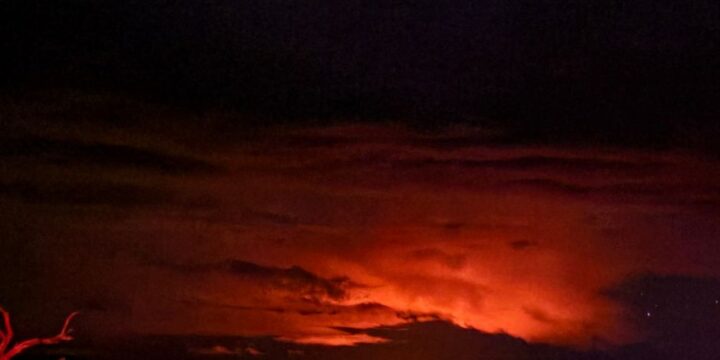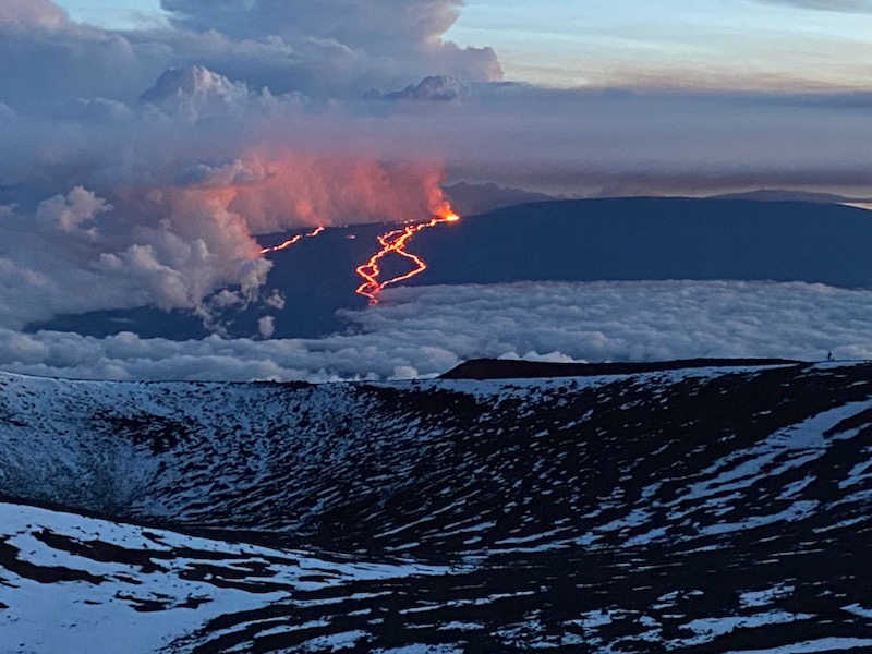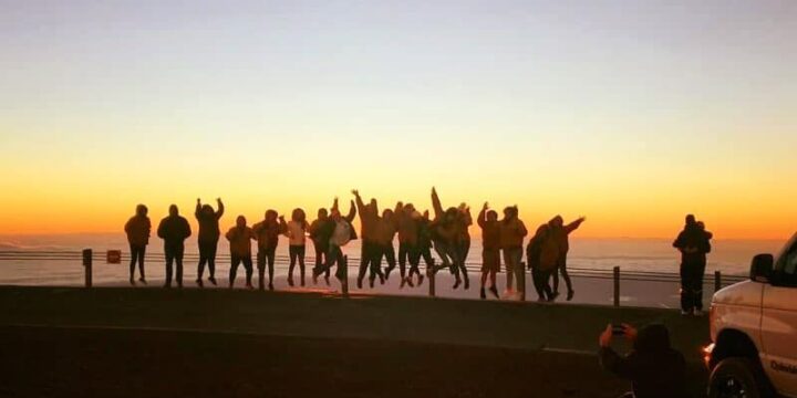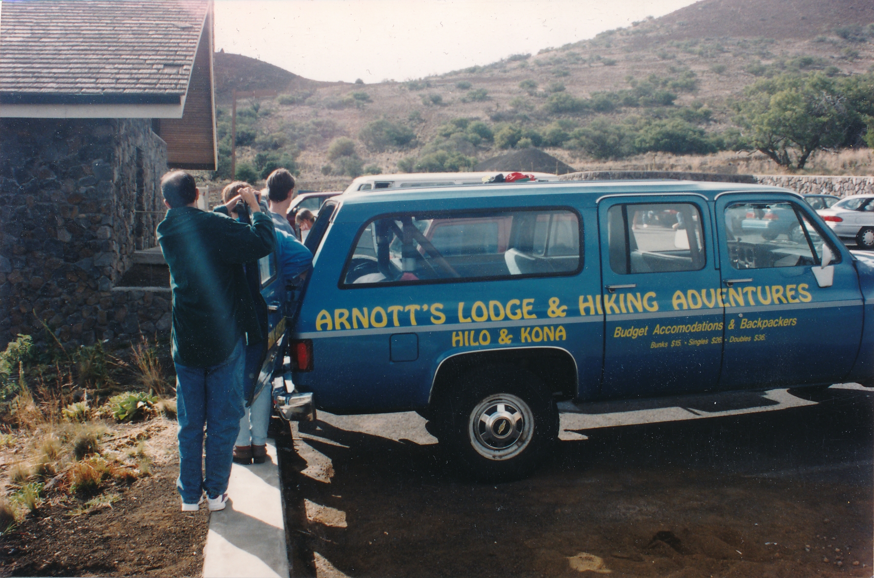
This past week we were given a gift in the form of several photos of Arnott’s Lodge and our Mauna Kea tour all the way back from 1995! We want to say a special thank you to Geerten Kalter of Delft, Holland, for sending us his pictures. We have been in operation since 1990 and are so grateful to all the people we’ve met along the way. Things sure have changed!
2023 starts with a new Kilauea eruption
Aloha to Arnott’s Guests and future guests!
This is an update to the current status of the Kilauea volcano and its eruption. As of January 10th, 2023, there is a spectacular lake of molten lava with one fountain that varies from a few to 30 feet or more in height (10m +.)
The Hawaii Volcanoes National Park staff have have prepared great viewing areas that are very close to the crater and allow spectacular photography. Be aware, however, that the full show does not begin until the sun sets (currently around 6:00 p.m.) and that large crowds and long waits for parking can be expected until about 9:00 p.m.
After 9:00 p.m. and until around 4:00 a.m. there are very few people in the park. It can be very cold at that elevation at night, so bring warm clothes and a hat or beanie for your head.
According to information we learned, but did not observe; around 4:00 a.m. those who want to see the lava and also the sunrise begin to arrive and it may get more crowded.
The first thing to know is that eruptions can stop and start over very short time spans, and there are excellent websites with cameras constantly broadcasting up-to-the-minute information. https://www.usgs.gov/volcanoes/kilauea/webcams
The next thing to know is that Hawaii, like the rest of the world, is critically short-staffed so do not book late flights into Hilo. If they are delayed, there may be no Uber, Lyft, or Taxis available, and rental car agencies do not wait up for you. You may spend the night at the airport! Buy travel insurance that covers delays.
Pack light, and use bags that YOU can carry and load, as there is no one to load your bags for you.
Almost all restaurants in Hilo close around 9:00 p.m., and only McDonalds drive-through is open 24 hours.
Be aware that the Kona airport (KOA) is a good 2.5 hour drive from Hilo, and we do NOT recommend that any first-time visitor drive this road (the Saddle Road, also known as Highway 200) at night.
Some hotels, many B&Bs, and vacation rentals have limited check-in hours. Be sure you know the limits of your accommodation.
We look forward to hosting many new and returning guests in 2023!
The New Eruption of Mauna Loa
On the evening of November 27th at 11:30 p.m., we were just getting ready to sleep when social media became alive with news of a lurid glow over Mauna Loa and that an eruption was in progress. This announcement followed months of increased activity after years of mild tremor recorded by sensitive instruments placed at strategic points on the mountain.
Of course in a very short time the Internet was flooded with pictures from 360 degrees around the mountain of very strong glow.
A quick visit to ever-patient HVO research Webcams on Mauna Loa’s NW corner of the Caldera Rim showed the entire Caldera of Moku’aweoweo flooded with very hot fresh Lava, and for a while it seemed like it would spill out the Southwest corner toward a very steep slope down toward South Kona communities and some residents even evacuated mindful of as little as 3 hours travel time from summit to sea.
Photo by Glory Arnott
In the morning of November 28th, some stunning footage began to appear on official and social media pages, including amazing footage from Paradise Helicopters’ early morning overflight of a breakout eruption on the old fissure line toward the Northeast, which includes historic flows toward the Mauna Kea turnoff and points East, including Hilo and a few miles short of Kea’au.
Everyone was on their devices getting updates as the flow developed and intensified, with high-volume fountaining and many rivers of lava headed downslope more or less toward about the 26 mile mark on the Saddle Road, or a few miles short of the Mauna Kea turnoff on the Hilo side.
As the hours went by, some fountains died while others sped up and a high volume of lava cut the access road to the Mauna Loa NOAA Observatory, a key player in monitoring CO2 in the atmosphere.
As of today, December 2nd, the fountaining has died down and the drain out to a lower 7000ft elevation has the flow stalled almost 3 miles from the highway.
Thousands of residents and visitors (some say 10,000 at a time), flocked to view the once in a lifetime spectacle and some have taken our Mauna Kea Sunset tour which gives a unique perspective from slightly HIGHER than the Eruption 25 miles across the Saddle between the two mountains. The last eruption of Mauna Loa was in 1984, 38 years ago. Right now is the first time in decades that both Mauna Loa and Kilauea are erupting at the same time.
Photo by David Collier
We have seen Photos or Images from Pro Cameras with huge lenses as well as iPhones and Androids, and all are spectacular…definitely as its night, your phone will catch colors but be a bit fuzzy on detail. Professional cameras on a tripod are producing AMAZING images and several webcams on Mauna Kea have been repositioned to catch elements of the eruption.
Photo by Andras Toth
Here at Arnott’s Lodge we have a few rooms available at more affordable prices than larger fully staffed Hotels AND we have daily space on our Mauna Kea Sunset tours that now include an overview of this amazing Eruption As you visit Hawaii please be aware that the world is short-staffed right now, so be patient with Airport Staff, Stores, Restaurants and yes, even at our Hotel, especially if you are arriving late as we also are short-staffed and may be personally checking you in.
Please also be aware that If Hawaii Island was a football field this eruption is taking up less area than a Hot Dog Stand. There is NO risk to your safety right now.
Photo by Sarah Garcia
Doug Arnott Discusses our SUNSET and stargazing Mauna Kea tour
Aloha guests and future guests.
My Blog today is about our Mauna Kea Summit tour and why some companies advertise the use of expensive telescopes while we use a Laser Pointer, and also why our emphasis is on SUNSET and not so much on stargazing.
Most people who go up Mauna Kea, have never experienced anything like this amazing adventure, nor have they experienced the clarity of our atmosphere that has you gasping in wonder with your eyes; not even with binoculars.
Many realize for the first time that we are part of a highly visible VAST galaxy that looks like a River of closely associated Stars in their Billions: this is what drove ancient Egyptians to build the Pyramids in perfect alignment with this River.
If you want to look through a telescope at one object among the billions; fine, step into the line of 9 other guests (Covid rules) or soon to be 14 other guests and wait your turn in the freezing cold. Try to adjust your wide open vision to the focused light in the telescope and often leave in frustration…using a high powered telescope is an art that takes time to assimilate.
We have evolved a far superior method of introducing you to the wonders of the Universe….a laser pointer powerful enough to seem to go all the way to the object….so as the heavens roll around their seasonal changes and we make our way around the Sun once a year we may be able to show you the North Star and the Southern Cross in one sweep and ooops there goes the International Space Station…try doing that with a Telescope. We show you the clusters and individual bright Stars that ancient Hawaiians used to navigate the Pacific and to Tahiti and back. We show you zodiac signs as they occur during the year.
There is another important reality which is why we emphasize SUNSET and diminish Star Gazing; the simple fact that there are MANY nights on Mauna Kea that either the Moon’s brightness or cloud cover lower on the mountain preclude any Stargazing at all. Mauna Kea is an almost 14,000ft spire sticking up out of the Pacific and makes a lot of its own weather out of passing Trade-wind driven moisture or East Bound cold fronts crossing the Pacific to become mainland storms. The moon itself for a week before the full moon makes stargazing virtually impossible…is that the week you’re going with another company because we don’t have a telescope? There are also individual Rangers on Mauna Kea that can alter your experience by insisting all leave the summit immediately after sunset and go all the way down to the Visitor Information Station, while other more public oriented rangers will allow some limited Stargazing well below the summit but well above the VIS….these are variables that most companies will not bother to explain….that in fact ANY Stargazing is subject to pure Luck.
Go to Mauna Kea for the Sunset and if you get some Stargazing with or without a telescope that is a bonus. AND please be aware that rarely but on occasion incoming storm systems that have not closed the road can block a good Sunset. Your Operator, no matter who they are, have no control over this and YOUR Karma may be involved, so if we get you to the top safely we have done a good job.
If you want to do In-Depth Stargazing with an amazing Operation set up for the specific purpose, in the warm air at Sea Level, go to Stargazehawaii.com. Email: stargaze@stargazehawaii.com Operator: Wayne Fukunaga (808) 323-3481 is well known. He operates at several west side resorts and enables even the youngest members of your family to participate. Wayne has four Telescopes so you are not standing in line and not cold…he also showcases the various Apps available and how to use them, giving you a lifetime of enjoyment ahead.
Lastly we do HIGHLY recommend that you invest in a small but good quality pair of binoculars and learn how to use them both for daytime and night star gazing.
Enjoy your Mauna Kea experience: just to go up in a rugged 4×4 is an Adventure.
Doug’s Blog on Visiting the Big Island during COVID
Aloha All Visitors reading my Blog.
The problem for any destination that has a Main Feature is how to draw visitors to come when that feature is not doing its thing.
The burning question is whether the destination has other charms for Visitors besides its main feature.
Paris without the Eiffel Tower is still amazing Paris, Japan without Mt Fuji is still rich in culture and scenery.
Many have visited Italy many times without seeing Rome or the Volcanoes.
And so it is with the Big Island, or as our Visitor Bureau likes to call it, “Island of Hawaii”.
For a start this is a BIG Island with three Huge Mountains: two over 13,000ft above sea level. One is Mauna Kea, which you can drive (4×4) or take a tour
to the top, the other is Mauna Loa, which hosts the famous NOAA Science Station that monitors World CO2.
We have a Windward side and a Leeward (west side ) that are completely different in character providing variety for your visit.
We have world ranked beaches with Lifeguards and small rocky coves where you can observe Green Sea Turtles feeding in nature.
There are White sand beaches formed from Coral and Seashells, Black Sand beaches formed from eroded Lava and
Green sand beaches formed from wind separation of Olivine from old Lava.
Once a year around Easter Hilo becomes the Hula Capital of the world for the Annual Merrie Monarch Festival where all hotels are booked out a year in advance and the most amazing costumes are created using flowers and foliage from the surrounding countryside.
In a little known fact Hilo has the highest per capita participation in youth soccer of any town in the USA.
While Covid played havoc with restaurants nationwide, Hilo responded with a rich variety of delivered food and beverages of every kind.
Hilo has several unique Bistro style restaurants with great food and wine selections. We have one Liquor Store: Kadota’s, run by a family famous for its
absolutely world class selections and its “Back Room” where serious wines from around the world can run to hundreds of dollars…and we have unique
Farmers Market food stalls selling a vast variety of foods representative of our diverse cultural heritage. Hilo’s Farmers Market is a must every Wednesday
and Saturday for fresh vegetables, fruits of every kind and even the Coconut vendor to lop off the top and give you a “fresh from the tree” nut with a straw.
Getting to the Island of Hawaii has never been easier with many major Carriers having direct flights from Mainland Cities to Kona and both Hawaiian and Southwest offering numerous daily flights from Oahu to Hilo. Just be aware that Hilo while under 100 miles from Kona is a good two hour drive in daylight and we discourage our guests from driving it at night for their safety, and that of wandering nocturnal Donkeys, Goats and Pigs.
As our accommodations have evolved, most budget priced accommodation is on the Windward (Hilo) side of the Island and most Luxury Resort Hotels are on the Kona (Leeward) side…so if coming to Hilo, plan your Kona flights accordingly to arrive with enough daylight to get to Hilo.
If your plans take you to Oahu first you can fly into Hilo on Hawaiian or Southwest many times a day and all the usual Car Rentals are available here.
When Covid is over, United Continental has a once a day direct flight into Hilo from LA which arrives around 7pm and departs at around 10pm…this is a great flight if you can capture the price break times.
So lets get down to why you are coming to the Island of Hawaii and that pesky Volcano that may or may not be erupting visible Red Lava.
With or without any visible Lava the Volcanoes National Park is a must visit especially if you are Hikers or interested in Geology…it is well set up with descriptive plaques at all main features and is at the 28 mile point going south, at the 53 mm is the town of Pahala frozen in time from the Sugar Plantation Era and be sure to buy its new product Kau Coffee which has already reached world attention…at the 56 mm is Punalu’u Black sand beach famous for the many Green Sea Turtles that regularly haul out on the sand for a rest…continue on 10 miles to Naalehu Town the Southernmost Town in the United States with its Famous Punalu’u Sweetbread Factory…a must visit. From Naalehu to Green Sands Beach trailhead is 16 miles and takes you past South Point, the South most point in the USA. Google maps knows “Green Sand Beach Trailhead”…there are often people with pickup trucks offering rides, it is a rugged trail and banned to Rental cars…DO NOT leave anything valuable in your car.
Back in Hilo for your next day you may decide to visit the aftermath of the enormous 2018 Eruption that destroyed over 700 houses and you can pass through the famous “Wild West” Town of Pahoa on the way to highway 132 which is a road cleared over and through the 2018 Lava Flow…AMAZING. During recent heavy rain (3/21) rainwater filtered down to still 800f rock and came back up as dense steam making it difficult to drive, Highway 130 will take you to Kalapana, where another famous Lava Flow stopped at Uncle Roberts Hawaiian Village and leads you to Highway 137 that will take you to Pohoiki the enormous new Black Sand Beach formed by the 2018 Lava Flow.
You can drive out a short distance from the listed end of highway 130 out to the flat Lava Fields that once allowed visitors to walk right up to slowly advancing flows…today some property owners have returned and erected shacks and in some cases elaborate house on top of the Lava that inundated their land…Please act with respect if visiting this area and drive very slowly so as not to create dust.
Off for another full day we are going North along the Hamakua Heritage Coastline on Highway 19. First turn is just out of Hilo not even a mile there is a scenic turn out on the right that overlooks the Harbor and the massive Breakwater that protects it. Depending on weather and ships this point can provide spectacular views of Shipping and sometimes huge surf conditions. Continue on to the Scenic Route just past the 7 Mile Marker which will lead you through magic dense forest to views of Onomea Bay and the Botanical Gardens…a short distance on is “Whats Shakin” a wonderful fruit smoothie shop. You will rejoin the highway and drive to the Honomu and Akaka Falls turnoff just by the 14 Mile Marker. Honomu is an old sugar town and that big cut you came through on the highway below is the old railway line before they needed roads…keep going up to Akaka Falls….you can park on the side and walk a ways or drive right in and pay for parking…either way its an over 400ft waterfall and very beautiful.
As you travel north from Honomu you will pass over bridges that once held Sugar Cane Trains while a crude road snaked around below. Each of these bridges crosses a valley and most are worth stopping for a look…..almost all have upstream waterfalls in view…DO NOT slow down on the bridge pull off the road before or after…plenty have been before you and pullouts are obvious…you will also pass Iconic small towns each held the cane workers for an area and some had sugar mills to partly process the cane before roads. At the 25 mile mark you will enter Laupahoehoe a small town with a STRICT 45 mile speed limit and the only gas station and food stop before Honokaa the next medium size town where our manager Glory was born and went to High School. Honokaa has weathered the loss of sugar and the new cross Island Saddle road (which cuts passing traffic) better than others and has converted its main street to shops of more interest to visitors….if you are headed to Waipio Valley the Malama Market at the main intersection is the place to stock up.
If you follow the road into Honokaa you will miss another Icon of old Hawaii…Tex’s drive in with its famous Malasadas which is on highway 19 above Honokaa…either way BOTH are worth a visit….but back to Waipio Valley…drive through Honokaa Town by taking a right off the highway, pick up supplies at Malama Store and you have 9 miles to go to the Waipio Valley overlook…this alone is worth a visit and is also the entry point for Hikers and Adventurers to try some famous trails and waterfalls….be sure to get latest info on arrival as there has been a swirl of proposed law changes lately to restrict the access which is a precarious 4×4 only, 25% grade hill down and up with narrow one way in the middle. This is a hike takeoff point for Waimanu Valley: a rugged A grade hike by any standard.
Continuing on our trip around Mauna Kea you will return to Honokaa and make your way back up to the highway and turn toward the next town Waimea. This is a cute mix of old and new, has two competing shopping areas across from each other and hosts both Burger King and McDonalds as well as specialty shops and a food court. One restaurant you should not miss is the Lilikoi Cafe around the back of Parker Ranch Center…with a great selection of healthy food and pastry.
The town of Waimea hosts the headquarters of several world class telescopes that can be seen on the distant summit of Mauna Kea as well as Parker Ranch with its history and huge acreage…there is also a Western Style store, a Food Court, Health food and regular Food Markets
At this point we turn back toward Hilo on highway 190 to return via the famous Saddle Road where we will rise to 7000ft to cross between Mauna Kea and Mauna Loa mountains on our way back to Hilo…but before we start to climb from Waimea at 2500 ft we cross a vast flat plain of wind blown grasslands that is part of Parker Ranch, arriving at about the 10 mile marker we have a choice as the Old Saddle Road Hwy 200 forks off to the left…this a very scenic but narrow and twisty road that meets the cross island highway about 15 miles toward Hilo….OR you can continue on 10 miles to the intersection with Daniel Inouye Highway which is a wide modern Highway all the way to Hilo, most of it 60mph but be aware of slowdown passing the Military training area as it is well Policed. Both Routes are incredibly scenic with 3 major mountains surrounding you, A stop at the mid way Gil Kahele County Park is a must for well maintained bathrooms and to take in the scenery at 7000ft…this Park and its surrounding are also a great place for night Stargazing and Meteor watching.
The scenery on the Saddle Road is so diverse it takes a book to describe so just enjoy and pull out on wide shoulders to take in amazing scenery, as you continue on toward Hilo mile markers will be counting down so as you approach 29 and 28 slow down as you are on a VAST very flat plain of relatively smooth Lava that stretches in all directions….this is the 1934 Mauna Loa Lava flow that formed a huge glowing lake that had to get deeper and deeper to overwhelm the small ridge at the 28 mile marker where it then flowed toward Hilo.
At this point at the 28 mile marker is the turn off to Mauna Kea Visitor Center and if you have a 4×4, access to the summit. It is up to 20% grades to get to the Visitor Information Station ( VIS ) and you need good brakes and use of lower gears to get safely back down…if it is late in the day you may want to come back on a separate visit as Mauna Kea can be a day by itself…
You now head down a continuous Hill for the next 28 miles into Hilo and you drop over 6500ft in altitude, the highway is very well made and most is 60mph but be cautious of over use of brakes to hold speed to the limit as many vehicles get burned out brakes on this one descent…as your vehicle tries to exceed the speed limit first turn off Overdrive if you have one…if there is no overdrive downshift your automatic from D to a lower gear 4, 3, or 2 so as the engine is holding you at the limit and not repeated use of brakes. Arriving at the end of the highway you can take a short jog to the right then an immediate left which brings you in a couple of miles to Hilo’s Fast food center at Puainako Center and only 10 or 15 minutes from our Lodge.
Thank you for taking this journey with us, we will be adding pictures soon so that even if you can’t come soon….you can enjoy the Big Island with or without Lava Flowing.
Doug Arnott
Mr. Arnott’s January Blog
Aloha to those joining my blog…..
There is a move afoot on Oahu to encourage mainlanders who want to (individually or with family) come to Hawaii for remote work, to fulfill their dream by offering good rates for longer stays into months for qualified applicants.
We recently had an experience with 30 college-age students who would have gone on overseas trips but, because of Covid, had to stay in the US. This group stayed with us for 3 months, from Sept. through Nov. last year and taught us a great deal about longer-term stays, which we have never entertained before.
One of the things we had to provide was really fast Internet for them, and after a new contract with Spectrum and about $4000 to a local Tech company, we had gigabyte speeds translating into 200mbs for laptops on WIFI…these 30 students had over 70 devices hooked up at any one time…leading us to believe we have THE best WIFI in Hilo.
Added to this we have extensive grounds allowing for far greater than 6ft distancing, and our location is near several ocean access points which are used for recreation by people from other suburbs as our area provides the Lungs of Hilo where pure tradewinds make their first landfall.
Beware of offerings on Hilo Harbor, which is perennially brown from glaciated runoff from Mauna Kea Mountain. We are right by the Blue Pacific Ocean….but not too close as recent HUGE surf has demonstrated.
The group that we had used EVERY food service and delivery option available in Hilo, and we were frankly stunned at the variety and competition to provide delivered food and beverages.
For your comfort we have Fujitsu Split or Ductless Aircon and double-pane windows to guarantee you a good nights sleep.
We also have extensive common areas where guests can meet with appropriate distancing to exchange ideas or form business partnerships.
Hilo is in the grips of the Pickle Ball craze and our GM Glory can introduce you to our local players. Hilo has the distinction for kids of being one of the top Soccer towns in the nation for per capita players.
For this type of accommodation email me direct at arnottd@gmail,com or Glory at manager@arnottslodge.com. We have 9 two-bedroom suites with kitchenettes and a few single rooms in this category and expect them to go fast.
Hilo is low-key with low Covid rates, and the Big Island population hovers around 200,000 with a very low infection rate.
We look forward to serious inquiries..
Doug Arnott
Hurricane Season in Hawaii
Guess what time of year it is! That’s right, it’s hurricane season in Hawaii!
Every year from the beginning of June to the end of November, Hawaii has its eyes on the Pacific Ocean from Mexico to Japan, watching for weather disturbances. The Central Pacific Basin, in which Hawaii squarely sits, is monitored constantly by NOAA (the National Oceanic and Atmospheric Administration.) Our busiest month for hurricanes is usually August, followed by September.
Let’s be real: Hawaii is in a blessed spot. Hurricanes rarely strike us directly, and there are some good scientific reasons for this. First, Hawaii is a small target in a big ocean. The Pacific is the largest and deepest ocean on the planet: it covers about 63 million square miles and contains more than half of the free water on earth. Hawaii is not a large landmass, so right off the bat, a hurricane would have to move just right in order to hit it. Second, Hawaii is protected by the cooler water of the Central Pacific. Hurricanes thrive in warmer waters, so they’re usually generated near the Mexican and Central American coastlines in the shallower water during the summer and early autumn months. As they’re pushed across the Pacific ocean towards the west by prevailing trade winds, they hit the cooler deeper water of the Central Pacific. (Click here to read more about “upwelling” and the process by which ocean temperatures change.) Once they hit that cooler water, these hurricanes become vulnerable to winds coming from other directions that can tear the storm apart. Why? Because the hurricane no longer has access to all of that easy evaporated water it had over warmer ocean waters. The evaporating water is its fuel. This is another reason why hurricanes tend to fall apart quickly once they make landfall. (NatGeo.)
If a hurricane follows a more southerly path, there’s a better chance of it reaching the islands. For example, Hurricane Iniki came from the south of the islands and swung northward just after it passed beneath us. It was able to keep feeding off of the warmer equatorial waters and maintain its strength.
Most of the time, the cooler waters brought down from Alaska into the Central Pacific kills or weakens any storm that attempts to approach from due east. It’s a fact that “Virtually every system approaching Hawaii from the east since 1950 tracking at least as far north as the latitude of the Big Island of Hawaii eventually weakened to a tropical storm or depression by the time it reached the islands.” (Weather.com.) However, in an El Nino year, the chance of a hurricane tracking within 100 miles of the islands increases by 13%. This is due to El Nino’s effect on ocean water temperatures. Both of Hawaii’s most recent destructive hurricanes (Iniki and Iselle) happened during El Nino years.
Back to reason number 3 why hurricanes rarely hit us directly: wind shear (or hurricane poison, as you could think of it) is usually stronger near the Hawaiian Islands. Wind shear is the rapid change in wind speed and/or direction over a short distance, and the wind shear around Hawaii is usually what takes hurricanes apart. It has also been posited that Mauna Loa and Mauna Kea, the two giant volcanoes dominating the landscape of the Big Island, have an effect on wind circulation when storms attempt to make landfall here. Although they won’t have much effect from a distance, any storm that hits the Big Island directly will probably die a swift death.
It’s probable that due to climate change and the warming of the oceans, Hawaii will begin to see an increased number of storms. One current prediction is an increase of 15% per decade (Forbes.)
However, data is still being collected and only time will tell exactly how many heavy storms Hawaii could see in the future.
Don’t let this slow you down if you’re thinking of visiting! Hawaii is a wonderful place full of beauty and aloha, and big storms are still so rare here that the usual response of locals to dire weather predictions is humorous jokes. The key to hurricane preparedness is to stay informed and pay attention to the NHC.
By S. Garcia
Hawaiian Terrestrial Life
Sitting outside on the lanai, enjoying a cool drink and relaxing sea breeze, listening to the crashing waves in the distance…and then you hear it. This small, two-tone animal call. Most visitors to the Island think it is a small bird….but what bird is awake at night? It is actually a tiny, invasive frog endemic to Puerto Rico; the Coqui Frog. They are only one of the many species that somehow managed to find their way to one of the most remote islands in the world.
As you travel around this beautiful island of Hawai’i, the diversity of plants and animals across the island is absolutely amazing! However, there is a darkness to that beauty. Much of what is seen across the island did not originate here, nor does it belong. Hawai‘i is considered to be the most remote island chain on the planet. We are farther from any major landmass than any other island. That said, it is extremely difficult for any organism to get here, and once here, it is just as difficult to leave.
The Endemic and Native Life of Hawai‘i Island (The Good)
Hawai‘i is home to only two endemic mammals, the Hawaiian Hoary Bat (ʻōpeʻapeʻa), and the Hawaiian Monk Seal (ʻIlio-holo-i-ka-uaua). When we say endemic, we are referring to the fact that these particular species of animals are found here in Hawai‘i, and nowhere else on the planet.. All other mammals found on the island (yes, including the infamous homo sapien), are considered to be non-native, and even invasive!
** Both of these animals are on the US Fish & Wildlife Service Endangered Species list! They made it into this list because they compete with other organisms for the limited food and space on the island.
Fun Fact! The Hawaiian Hoary Bat is the Hawai‘i State land mammal!
Of course, there are many other endemic creatures on Island! Many of which are avian. These include the Hawaiian Owl (Pueo), Hawaiian Hawk (‘Io), a few different Honeycreepers: ‘Apapane, ‘Amakihi, and ‘I’iwi (Scarlet Honeycreeper), Hawaiian Goose (Nēnē)…etc.
The ‘I’iwi (left) also looks very similar to the ‘Apapane (right) with one major difference being the beak!
‘Apapane, is also the bird the street our lodge is located on was named after! 😀
Fun Fact! The Nēnē, although a descendant of the Canada Goose, is the Hawai‘i State Bird!
The Invasive Life of Hawai‘i Island (The Bad)
Some of the most noticeable creatures around the island, aside from the noisy Coqui, as mentioned above, tend to be the most invasive. These creatures are ones that were introduced to the island, both intentionally and unintentionally.
These creatures that find their way here come via the 3-W’s; Wind, Wings, and Waves. While they are frowned upon, as invasive species, those that are surviving on island are the “lucky ones”! It is said that 1 species, every 35,000 years, makes it to island and survives. The rest either perish en route, or shortly after arrival.
These species tend to be more commonly spotted, as compared to natives. This is because before these invasive creatures found their way to island, the native and endemic lived peacefully, without predation! Once invasive organisms arrived, they began to prey on the natives, which had never had the need to evolve and protect themselves and their young, taking down their populations in great amounts. For example, the mongoose, which were introduced in order to hunt the ever growing rat population. Unfortunately, it turned out that rats are nocturnal, and mongoose are diurnal. *Fail* Additionally, mongoose are opportunistic feeders known to prey on native bird populations that nest on the ground, rather than in trees, as well as nesting turtle eggs. *Double Fail*
Another big invasive species that has caused extreme damage to unsuspecting native birds and land animals is the feral cat population. These cats were originally introduced to the islands by early Europeans, and without any major predator, their population has exponentially increased. In addition to their hunting habits, they also host a potentially lethal parasite (Toxoplasma gondii) that contaminates terrestrial, freshwater, and marine environments! Of course, we can take up an entirely new post about that later.
Intentional introduction / intentionally brought to the Island: Mongoose, Cat, Wild Pig.
Unintentional introduction: Gold Dust Day Gecko, Coqui, Fire Ants.
(And the not-so Ugly)
Of course, not ALL introduced organisms are invasive. There are many that, while introduced and can become particularly annoying, peacefully coexist with the natives. These include Japanese White-eye, House Sparrow, Myna, Saffron Finch, Spotted Dove, Kalij Pheasant….and many more.
The relative harm posed by these introduced organisms is the subject of many discussions among conservationists. If you visit Hawaii, you can expect to see most of the animals listed here and many more! Hawaii is a known repository of non-native life.
Blog by B. Fuemmeler
Volcanoes of Hawaii
In lieu of the most recent fissure eruption in the Puna District of the Island of Hawai‘i, we want to clear up some confusion about our volcanoes. Unlike the rest of the volcanoes that surround the Ring of Fire, the Hawaiian Islands were and still are created by a hotspot magma chamber in the asthenosphere. Over this hotspot, the Pacific Tectonic Plate slowly moves. Due to this type of uprising of magma, our Hawaiian Islands form as shield volcanoes.
So what is the big confusion? As most of the world is not familiar with the idea that there are many different types of volcanoes and lava flow events, one of the biggest things has been that many people have thought that the eruptions have been signs that we will be the next Mt. St. Helens or Mt. Vesuvius eruptions. THIS IS WRONG! Mt. St. Helens and Mt. Vesuvius are identified as Stratovolcanoes. Most stratovolcanoes are characterized by their steep slopes, explosive eruptions, and highly viscous, pyroclastic lava flows. Over time, pressure builds up under layers of cooled lava that hardened before having the chance to flow any significant distance, then the pressure exceeds the strength of the cooled lava, causing a very strong, violent, explosion.
**One of the most recent examples of a stratovolcano is the sudden eruption of Mt. Fuego, just outside Guatemala City, on 3 June 2018. Unlike Mt. Fuego, our currently erupting shield volcano, Kilauea, has gentle slopes, and very fast moving ‘a‘a and pahoehoe flows. Our volcano, in fact, has been erupting since 1983, forming new landscapes across the south east part of the Island of Hawai‘i! Kilauea has been reshaping and adding to the island of many years, and it will likely continue for many more!
Life Cycle of the Hawaiian Archipelago!
Over the last 65 million years, the Pacific tectonic plate has been slowly moving over the same hotspot that Hawaii Island sits over today. In the beginning, the islands were nothing more than small submarine volcanoes, just like Lōʻihi, our newest forming island. As the hotspot feeds the volcano, and magma is brought to the surface of the lithosphere, the size of the island grows, eventually breaking the surface of the ocean. At this point it becomes an island, continuously growing, as the Big Island is still doing now, until the tectonic plate has moved away from the hotspot (e.g. all other Hawaiian Islands). Once the volcanoes become dormant, or extinct, the island begins to weather away, becoming smaller and smaller. Evidence of this: Notice the difference in size from Hawaii Island to Oahu, Kauai, and Niihau. Of course, not just size is indicative, but also the amount of steep valleys that have been carved out of the landscape due to rivers, as well as the amount of dirt that has formed. As these islands grow and shrink, coral reefs also grow, creating barrier reefs. The most well known is the Great Barrier Reef along the northeast coast of Australia.
Midway Atoll, in the Northwestern Hawaiian Islands.
As these islands become smaller and the reefs continue to grow, the island eventually forms a lagoon in the middle, and they become what is known as an atoll. Atolls are primarily coral reef ecosystems where the rate of growth of the coral is able to keep up with the rate of erosion of the extinct volcano/island. Check out this cool animation of the formation of an atoll!
However, once the coral can no longer keep up with growth, and the entire island has gone back below the surface of the water, it then is defined as a seamount. This is the last part of the cycle of an island before it is either levelled off to the seafloor, or is subducted into a trench.
TL;DR?? We, on the Island of Hawaii, as well as the rest of the state, are SAFE! It is perfectly safe to still visit Hawai‘i, and explore! The Islands are still open for business! We are not going to be the next Guatemala or Pompeii. The only thing you can’t currently do is go into the Puna District, nor can you visit Volcanoes National Park. We welcome all visitors from around the world to enjoy our beautiful beaches, hiking trails, mountain tops…and so much more!
Author: B. Fuemmeler
Marine Life in Hawaii
When you hear “Hawai‘i”, what do you first think of? Sunshine, the beach, and the ocean, right?
Many travelers coming to the islands often look forward to jumping into our warm waters, whether to surf and swim, or snorkel and dive! Just as the views from above the surface of the water are beautiful, the life and landscape under the water is just as breathtaking! To the untrained eye, everything under the water tends to look the same, with little to no diversity…however when you take an even closer look, you begin to realize life under the water is more than just a few rocks, fish, and turtles! There is an amazingly complex, and delicate ecosystem, just waiting to be fully understood.
Here in Hawai‘i, we have amazing reef systems that are home to a wide variety of fish, such as our tongue-twister state fish: humuhumunukunukuāpuaʻa (reef triggerfish, wedge-tail triggerfish, rectangular triggerfish; Rhinecanthus rectangulus) Photo by Keoki Stender
Over the years, Climate Change has been something that has been getting more and more press, as the arctic sea ice has shrunk to all new lows, and coral reefs across the planet have begun to “bleach” and die. The idea of warming may not be something we, as humans, can physically detect with our own senses, but the coral and other marine organisms can; even if it is only a couple of degrees difference! One of the main sources of climate change, on the large scale, is increased levels of Carbon Dioxide (CO2) emissions. While it is difficult to stop all CO2 emissions, there is something that EVERYONE can do, on a small scale, to help the reefs. In addition to reducing the amount of driving we do and the plastics we use, another major help to the marine ecosystem includes using REEF SAFE Sunscreen! According to a study in 2015, up to 14,000 tons of sunscreen ends up in the ocean, annually! That is a lot of chemicals for very sensitive organisms to come in contact with! These chemicals, once in the water column, are so small that they are able to be siphoned or absorbed into marine life, poisoning them as concentrations increase.
How to recognize dying coral reef: Coral Bleaching is one of the biggest tell-tale signs of a dying reef. While you are snorkeling, if the reef has a lot of life floating around it, with many colors all over, it is safe to say that it is a pretty healthy reef.
If the coral is starting to turn bleach white, or some will become super bright neon colors, there is something that is causing the coral to release all of its polyps and is dying. It is still possible for the coral to recover if we act now!
However, once the coral has begun to grown any sort of algae, it has died, and at this point it is unlikely to ever recover.
>> Staff recommendation by B: Watch the film “Chasing Coral”…a Netflix Original Documentary
What has Hawai‘i done? Effective January 1, 2021, Hawai‘i has signed a bill into law, banning the sale of all sunscreens that are believed to have reef harming chemicals, such as Oxybenzone and Octinoxate.
What can you do? Avoid sunscreens that include chemicals, such as Oxybenzone and Octinoxate! Whether you are along a coastline, or landlocked, these chemicals can find their way into our coastal waters, and eventually harm our marine organisms! Instead, choose a non-aerosol mineral sunscreens that only contains zinc oxide or titanium dioxide.
Here are a list of some sunscreens that are reef safe!
- Badger Unscented Sunscreen Cream
- Raw Elements Certified Natural Sunscreen
- Stream2Sea Mineral Sunblock
- Mama Kuleana Waterproof Reef-safe Sunscreen
- Kokua Sun Care Hawaiian Natural Zinc Sunscreen
- Manda Organic Sun Paste
What ELSE can you do to help our coral reef and marine life? Avoid single use plastics! Use reusable containers, bags, and utensils! Tell your restaurant server “NO straw please!”
ALSO, be careful where you are stepping when getting into and out of the water, as well as while you are in the water! Avoid grabbing hold to delicate coral. Avoid stepping on loose rocks, as there may be many little creatures hiding under them!
Author: B. Fuemmeler